Geographic Information System (GIS) mapping has quietly become one of the most powerful tools in the modern land planning and development toolkit. Across the American West, planners, engineers, developers, and government agencies are using GIS technology to make smarter, faster, and more informed decisions about how land is used, protected, and developed. In Idaho, a state experiencing rapid population growth and increasing pressure on its natural and urban landscapes, GIS mapping is playing a central role in shaping the future of communities large and small.
From the high desert plains of the Snake River Valley to the forested foothills of the Sawtooth Range, Idaho presents a uniquely complex geography that demands sophisticated tools for analysis and planning. GIS mapping provides exactly that, offering the ability to layer multiple types of spatial data, including topography, soil composition, zoning boundaries, utility infrastructure, flood zones, and land ownership, into a single visual and analytical platform. For anyone involved in land planning in Idaho, understanding how GIS works and why it matters is no longer optional. It is essential.
The Role of GIS Mapping in Modern Land Planning Across Idaho
Land planning in Idaho has historically been a challenging endeavor. The state encompasses over 83,000 square miles of diverse terrain, and coordinating development decisions across rural counties, rapidly growing cities, and protected federal lands requires precision and collaboration. GIS mapping has fundamentally changed how that coordination happens.
At its core, GIS mapping allows planners to visualize geographic data in ways that static maps and paper records simply cannot match. A planner working on a subdivision proposal in a growing Idaho community can use GIS to instantly assess slope gradients, proximity to wetlands, access to existing road networks, and potential conflicts with agricultural or conservation easements. What once required weeks of fieldwork and manual research can now be accomplished in hours, with greater accuracy and far less margin for costly errors.
State and local agencies across Idaho have integrated GIS mapping into their core planning workflows. The Idaho Department of Lands, the Idaho Transportation Department, and dozens of county planning offices now rely on GIS platforms to manage everything from wildfire risk assessments to transportation corridor planning. The result is a more coordinated and data-driven approach to land planning in Idaho that benefits developers, residents, and policymakers alike.
GIS mapping also supports long-range comprehensive planning, which is a requirement for most Idaho cities and counties under state law. By analyzing growth trends, demographic data, and land use patterns through GIS, planners can develop future land use maps that anticipate where development pressure will occur and ensure that infrastructure, schools, parks, and services are planned accordingly.
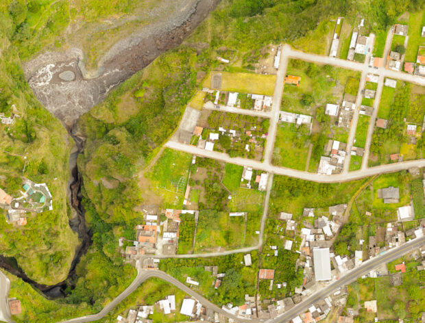
GIS Mapping in Nampa, ID: Supporting One of Idaho’s Fastest-Growing Cities
Few places in Idaho illustrate the transformative power of GIS mapping more clearly than Nampa. GIS mapping in Nampa, ID has become a cornerstone of how city and county planners manage growth, coordinate infrastructure improvements, and respond to the demands of one of the fastest-growing metropolitan areas in the United States.
Nampa, located in Canyon County within the Treasure Valley, has seen explosive population growth over the past two decades. That growth has brought with it intense pressure on land resources, transportation networks, utility systems, and public services. Managing that pressure responsibly requires real-time spatial data, and GIS mapping delivers exactly that.
The City of Nampa and Canyon County use GIS platforms to track parcel-level land use data, monitor development permit activity, manage stormwater and utility infrastructure, and coordinate with regional planning bodies like the Community Planning Association of Southwest Idaho (COMPASS). These systems allow planners and decision-makers to see not just where development is happening today, but where it is likely to happen tomorrow, and what infrastructure investments will be needed to support it.
For private developers and engineering firms working in Nampa, access to detailed GIS data is equally valuable. Site selection, feasibility analysis, and entitlement processes are all made more efficient when accurate spatial data is readily available. A developer evaluating a parcel in Nampa can use publicly accessible GIS layers to assess annexation status, zoning designations, proximity to utilities, and environmental constraints before investing significant time or capital in a project.
GIS mapping in Nampa, ID also supports emergency management and public safety planning. Canyon County uses GIS data to model flood inundation zones, identify vulnerable infrastructure, and coordinate response efforts during natural disasters or emergencies. In a region where the Boise River and its tributaries create real flood risk, this kind of spatial analysis is not just useful; it is critical for public safety.
How Land Development in Idaho Relies on Accurate Spatial Data
Successful land development in Idaho depends on more than vision and capital. It requires a deep understanding of the physical, regulatory, and environmental characteristics of any given piece of ground. GIS mapping provides developers with the spatial intelligence needed to evaluate sites accurately, navigate regulatory requirements, and design projects that are both feasible and compliant.
One of the most significant ways GIS supports land development in Idaho is through environmental analysis. Idaho’s rivers, wetlands, floodplains, and sensitive wildlife habitats are protected by a complex web of federal and state regulations. GIS mapping allows developers and their consultants to identify potential environmental constraints early in the due diligence process, reducing the risk of costly surprises during permitting.
Infrastructure analysis is another area where GIS mapping adds enormous value. Understanding where existing sewer lines, water mains, power corridors, and road networks are located, and how far a proposed development site is from each of them, is fundamental to estimating development costs and feasibility. GIS platforms allow this analysis to be conducted quickly and with a level of precision that was simply not possible with older tools.
Land development in Idaho also intersects with agricultural land preservation, a topic of growing concern as the Treasure Valley and other fertile agricultural regions face increasing development pressure. GIS mapping helps planners and policymakers identify prime farmland, track conversion rates over time, and design growth boundaries and transfer of development rights programs that balance growth with the preservation of Idaho’s agricultural heritage.
GIS Technology and the Future of Land Use in Idaho
As GIS technology continues to evolve, its applications in land planning and development in Idaho will only expand. Emerging capabilities in remote sensing, drone-based data collection, machine learning, and real-time data integration are pushing the boundaries of what GIS platforms can do, and Idaho’s planning community is beginning to take notice.
LiDAR (Light Detection and Ranging) data, now widely available for much of Idaho through state and federal programs, has revolutionized topographic analysis for land planning purposes. By capturing highly detailed elevation data from aerial surveys, LiDAR enables planners and engineers to produce precise terrain models, identify drainage patterns, and assess grading requirements with far greater accuracy than traditional survey methods alone.
The integration of GIS with Building Information Modeling (BIM) and digital twin technologies is also opening new possibilities for urban planning and development coordination in Idaho’s growing cities. These integrated platforms allow planners, engineers, architects, and public officials to visualize proposed developments in their full geographic context, simulating traffic impacts, stormwater flows, and visual effects before a single shovel of dirt is turned.
Cloud-based GIS platforms are making spatial data more accessible than ever before, allowing smaller municipalities and rural counties across Idaho to benefit from the same analytical capabilities once available only to large agencies with significant IT resources. As the cost and complexity of GIS tools continue to decrease, adoption across Idaho’s planning community will deepen.
Conclusion
GIS mapping has become an indispensable part of land planning and development in Idaho. From statewide resource management to hyper-local development decisions in growing communities like Nampa, the ability to collect, visualize, and analyze spatial data is transforming how Idaho grows and how it protects what makes it worth living in. For developers, planners, and public agencies alike, investing in GIS capabilities is not just a competitive advantage; it is a foundation for responsible, data-driven decision-making in one of the most dynamic land markets in the American West.
Need a Civil Engineering Company in Nampa, ID?
Our company has experience in all aspects of surveying, including topographic and boundary measurements, construction staking projects, sub division platting, and land development. We perform all stages of the work, starting with the initial survey before having experienced engineers come in for the preliminary and final stages of planning. Then, we’ll perform the construction staking, and do the final record drawings for projects. We know our success is linked to the success of our client’s project. We will work with you to define the scope of services and set an agreed-upon budget. Call us today!