Owning property in Idaho offers both freedom and responsibility, especially when it comes to understanding your property lines. Whether you’re settling in bustling Nampa or rural stretches of Canyon County, clear knowledge of your boundaries is essential. Property lines dictate where you can build fences, plant trees, or even allow livestock to roam. Yet, misconceptions about these invisible borders can lead to costly mistakes or conflicts with neighbors. This comprehensive guide will help you navigate the essentials of property boundaries in Idaho, offering insights into surveys, resolving disputes, and the value of hiring a qualified land surveyor.
The Basics of Property Lines in Idaho
Property lines in Idaho, like elsewhere in the U.S., represent the legal boundaries of a piece of land. These lines are established through legal descriptions in deeds and recorded plats, though they often remain unseen without formal markers. For landowners in Canyon County, understanding where your property ends and your neighbor’s begins is vital not just for practical reasons like installing fences or structures, but for protecting your investment from encroachments.
In many cases, property lines may not align with physical features like fences, hedges, or driveways. Historical use of the land or informal agreements between neighbors can create assumptions about boundaries that don’t reflect legal realities. This is where professional land surveying in Nampa or elsewhere in Canyon County becomes indispensable.
Why Property Line Accuracy Matters in Canyon County
In Canyon County, rapid population growth and expanding developments heighten the importance of knowing your exact property lines. Whether you’re buying a home, subdividing land, or preparing for construction, accurate boundaries safeguard your rights and prevent inadvertent violations. Ignoring property lines can lead to encroachments, where structures or improvements spill over onto neighboring land, potentially triggering disputes.
Accurate property lines also impact property taxes, insurance coverage, and the future resale value of your land. Mortgage lenders typically require a property survey before approving financing, underscoring the financial stakes. Moreover, resolving a boundary issue early—before it escalates into a legal dispute—can save significant time and money.
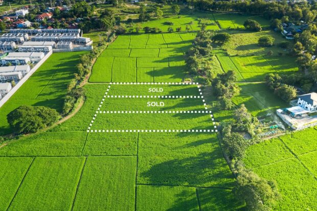
In agricultural areas, property lines take on additional significance. Farmers and ranchers in Canyon County often operate across large parcels, and misjudging a property line could disrupt operations or create conflicts over water rights, fencing responsibilities, or livestock movement.
The Role of a Professional Land Surveyor
To truly understand your property lines in Idaho, consulting a licensed land surveyor is often necessary. Land surveying in Nampa and throughout Canyon County involves the use of advanced tools like GPS equipment, total stations, and aerial drones to map and confirm property boundaries. Surveyors interpret legal descriptions from deeds, locate original survey markers, and may place new corner markers to clearly delineate property lines.
Engaging a professional land surveyor provides you with a formal boundary survey or record of survey, which becomes a legal document that can be filed with Canyon County. This document not only offers peace of mind but also provides concrete evidence if boundary disputes arise. When hiring a surveyor, ensure they are licensed by the Idaho Board of Licensure of Professional Engineers and Professional Land Surveyors, which governs qualifications and professional standards in the state.
For property owners in growing areas like Nampa, a survey is especially valuable when planning construction, subdividing lots, or developing raw land. Experienced local surveyors are familiar with Canyon County regulations, land development codes, and topographical challenges, ensuring a smoother process from planning to permitting.
Preventing and Resolving Property Boundary Disputes
Property boundary disputes in Idaho can arise from misunderstandings, incorrect assumptions, or disagreements over encroachments. Typical sources of conflict include misplaced fences, driveways crossing into neighboring parcels, or disagreements over shared resources like irrigation ditches. In Canyon County, where both suburban and agricultural land uses coexist, disputes may also involve livestock grazing, crop encroachment, or water access.
Preventing disputes begins with clear communication and documentation. Before initiating construction or making land improvements near a boundary, consult a land surveyor to verify property lines. Sharing survey results with neighbors fosters transparency and cooperation, reducing the likelihood of future conflicts.
If a dispute does arise, several steps can help resolve the issue. Consulting your deed and previous surveys provides a legal foundation, but a current survey often offers the clearest resolution. Mediation or alternative dispute resolution (ADR) can help neighbors reach amicable agreements without resorting to costly litigation. However, if necessary, property boundary disputes can be adjudicated in Idaho courts, where a judge may rely heavily on professional surveys to determine rightful boundaries.
By investing in accurate land surveying in Nampa or Canyon County early, property owners can avoid disputes and build better neighborly relationships.
Practical Steps for Landowners in Canyon County
Whether you’re a first-time homeowner or a seasoned rancher, understanding your property lines is a critical aspect of land ownership in Idaho. Start by reviewing your property’s deed and any previous surveys. If your property has never been formally surveyed—or if existing markers are missing or ambiguous—contacting a licensed land surveyor should be your next step.
Consider a boundary survey if you’re planning any construction or land improvements near your property’s edge. Even installing a simple fence can create problems if it crosses a boundary. Keep in mind that local building permits in Canyon County may require proof of property lines, particularly for structures near setbacks.
Communication with neighbors is equally important. Discuss any plans that involve shared boundaries and provide transparency through survey documentation. Open dialogue prevents misunderstandings and builds mutual respect—an invaluable asset in both urban and rural communities.
For larger landowners or those involved in agriculture, schedule periodic surveys to account for natural changes in the landscape or shifting property markers. Staying proactive not only protects your investment but ensures your property remains in compliance with local regulations and Idaho state laws.
Conclusion
Understanding and maintaining your property lines in Canyon County isn’t just about following regulations—it’s about protecting your property, avoiding conflicts, and ensuring your land serves you as intended for years to come. Whether through consulting a professional land surveyor, conducting thorough research, or fostering communication with neighbors, taking these steps will provide peace of mind and help you navigate Idaho property ownership with confidence.
Need a Civil Engineering Company in Nampa, ID?
Our company has experience in all aspects of surveying, including topographic and boundary measurements, construction staking projects, sub division platting, and land development. We perform all stages of the work, starting with the initial survey before having experienced engineers come in for the preliminary and final stages of planning. Then, we’ll perform the construction staking, and do the final record drawings for projects. We know our success is linked to the success of our client’s project. We will work with you to define the scope of services and set an agreed-upon budget. Call us today!