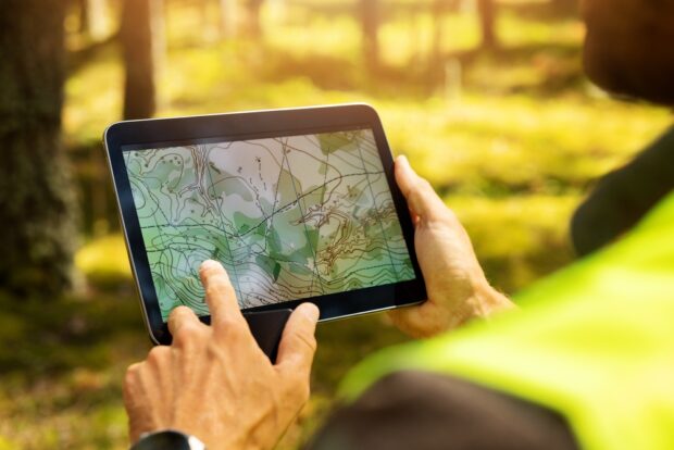
Land surveying is a critical component of urban development, real estate, and infrastructure projects. In Nampa, ID, a city experiencing rapid growth, advancements in technology have drastically transformed how surveyors operate. From drones to GPS, these innovations have made the process faster, more accurate, and cost-effective. This blog explores how technology is revolutionizing land surveying in Nampa, ID, and what it means for the future of this essential industry.
The Evolution of Land Surveying Technology
Traditionally, land surveying was a labor-intensive process requiring physical measurements and manual calculations. Surveyors relied on tools such as theodolites, chains, and levels to map out land parcels and determine boundaries. While effective, these methods were time-consuming and prone to human error.
With the introduction of advanced technology, the industry has undergone a significant transformation. Innovations like GPS, drones, and specialized software have made it possible to achieve unparalleled precision and efficiency in land surveying.
Early Technological Innovations
In the late 20th century, total stations—devices that combine electronic distance measurement (EDM) with angle measurements—began to replace traditional tools. These devices improved accuracy and streamlined workflows. However, the real revolution came with the advent of GPS and, more recently, drone technology.
The Role of GPS in Modern Land Surveying
How GPS Works
Global Positioning System (GPS) technology uses satellites to provide precise location data anywhere on Earth. Survey-grade GPS systems are capable of pinpointing locations within a few millimeters, making them indispensable for land surveying.
Benefits of GPS in Land Surveying
Accuracy and Precision
One of the most significant advantages of GPS is its accuracy. Surveyors in Nampa, ID, can rely on GPS technology to establish exact boundaries, eliminating discrepancies and reducing disputes.
Speed and Efficiency
Using GPS, surveyors can complete tasks in a fraction of the time required by traditional methods. This efficiency is particularly beneficial in a growing city like Nampa, where construction projects demand quick turnaround times.
Accessibility
GPS technology allows surveyors to access remote or challenging terrains easily. This capability is crucial in Nampa, where varying landscapes—from urban areas to agricultural fields—require diverse surveying approaches.
The Rise of Drones in Land Surveying
What Makes Drones a Game-Changer?
Drones, or unmanned aerial vehicles (UAVs), have taken land surveying to new heights—literally. Equipped with high-resolution cameras and sensors, drones can capture detailed aerial imagery and topographic data quickly and efficiently.
Applications of Drones in Land Surveying
Aerial Imaging
Drones provide a bird’s-eye view of a property, offering comprehensive visual data. This capability is invaluable for large-scale projects in Nampa, ID, where traditional methods may struggle to cover extensive areas.
Topographic Mapping
With advanced LiDAR (Light Detection and Ranging) technology, drones can generate detailed topographic maps. These maps are essential for construction, environmental assessments, and urban planning.
Monitoring and Inspection
Drones are also used for ongoing project monitoring. Surveyors can easily inspect progress, identify potential issues, and ensure compliance with plans.
Advantages of Drone Technology
Cost-Effectiveness
While the initial investment in drone technology may seem high, the long-term savings are substantial. Drones reduce labor costs and minimize the need for expensive equipment rentals.
Time Savings
A drone can survey a large area in a matter of hours, a task that could take days using traditional methods. This speed allows developers in Nampa to meet tight deadlines.
Safety
Drones eliminate the need for surveyors to navigate hazardous terrain, significantly reducing the risk of accidents.
Combining Drones and GPS for Superior Results
The integration of drones and GPS technology represents the pinnacle of modern land surveying. Surveyors in Nampa, ID, can use GPS to establish ground control points and drones to capture aerial data. Together, these tools create highly accurate 3D models and maps, enabling more precise planning and execution.
Practical Example: A Subdivision Project in Nampa
Imagine a developer planning a new subdivision in Nampa. Using GPS, surveyors mark the property’s boundaries and establish key points. Then, drones capture aerial imagery and topographic data. The combined data is processed using specialized software to create a comprehensive model, ensuring every aspect of the project aligns with the developer’s vision.
Advanced Software and Data Processing
Mapping and Modeling Software
Modern land surveying doesn’t stop with data collection. Advanced software plays a crucial role in processing and analyzing the information gathered by GPS and drones. Programs like AutoCAD Civil 3D and ArcGIS allow surveyors to create detailed maps and models with ease.
Real-Time Collaboration
Cloud-based platforms enable real-time data sharing and collaboration among team members. This capability is especially useful for large projects in Nampa, where multiple stakeholders need access to updated information.
Enhanced Decision-Making
By integrating data from various sources, advanced software provides actionable insights, helping developers and planners make informed decisions.
Challenges and Considerations
While technology has revolutionized land surveying, it’s not without challenges. Surveyors in Nampa must consider factors such as:
Regulatory Compliance
Both drones and GPS are subject to regulations. For instance, the Federal Aviation Administration (FAA) governs drone operations, requiring proper licensing and adherence to flight restrictions.
Data Management
The sheer volume of data collected by modern tools can be overwhelming. Effective data management systems are essential to ensure information is organized and accessible.
Training and Expertise
Advanced technology requires skilled operators. Surveyors in Nampa need ongoing training to stay updated on the latest tools and techniques.
The Future of Land Surveying in Nampa, ID
The continued growth of Nampa demands innovative solutions for land surveying. Emerging technologies, such as artificial intelligence (AI) and augmented reality (AR), promise to take the industry even further. For example:
AI in Surveying
AI can analyze large datasets quickly, identifying patterns and anomalies that might be missed by human operators. This capability will enhance decision-making and improve project outcomes.
AR for Visualization
AR technology can overlay survey data onto real-world environments, providing an immersive way to visualize projects. Developers and planners in Nampa could use AR to “see” how a proposed building will look in its actual location.
Conclusion
The integration of technology into land surveying has transformed the industry in Nampa, ID. From drones capturing high-resolution aerial data to GPS providing pinpoint accuracy, these advancements have made surveying faster, safer, and more efficient. As the city continues to grow, the adoption of cutting-edge tools and techniques will ensure surveyors can meet the demands of modern development.
For anyone involved in land surveying in Nampa, ID, the future is bright. Embracing technology not only enhances the quality of work but also sets the stage for a more sustainable and innovative industry.
Need a Civil Engineering Company in Nampa, ID?
Our company has experience in all aspects of surveying, including topographic and boundary measurements, construction staking projects, sub division platting, and land development. We perform all stages of the work, starting with the initial survey before having experienced engineers come in for the preliminary and final stages of planning. Then, we’ll perform the construction staking, and do the final record drawings for projects. We know our success is linked to the success of our client’s project. We will work with you to define the scope of services and set an agreed-upon budget. Call us today!

