
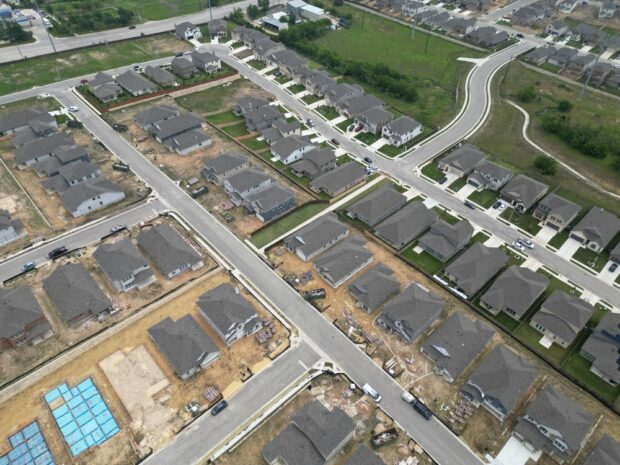
Subdivision roadway design affects far more than how cars move through a new neighborhood. Around Nampa, the street network must fit local development standards, connect appropriately with surrounding roads, accommodate drainage and utilities, and support safe access as Canyon County continues to grow.
The earlier roadway requirements are considered in site planning, the easier it is to identify right-of-way needs, access constraints, intersection considerations, and infrastructure improvements before they create conflicts later in design.
Quick answer: Developers planning Idaho subdivisions should evaluate roadway classification, right-of-way, street geometry, access, connectivity, drainage, pedestrian facilities, utilities, traffic impacts, and the standards of every agency with jurisdiction. In the Nampa area, that may include the City of Nampa, Nampa Highway District No. 1, Canyon County, or the Idaho Transportation Department depending on the property and roadway connections.
What local developers should know
-
Roadway jurisdiction should be confirmed early because design requirements can change depending on whether a project connects to a city street, highway district road, or state highway.
-
Nampa standards address street sections, right-of-way, sidewalks, access, connectivity, and traffic impact studies as part of subdivision planning.
-
Properties outside city-maintained areas may fall under one of Canyon County’s highway districts, including Nampa Highway District No. 1.
-
Roadway layouts should account for future connections to neighboring undeveloped parcels rather than treating each subdivision as an isolated street system.
-
Drainage, utility placement, emergency access, and pedestrian infrastructure should be coordinated with roadway geometry instead of being added after the street layout is established.
Why Roadway Design Matters for Subdivisions in the Nampa Area
Roadway design matters locally because new subdivision streets must function as part of a larger and rapidly evolving transportation network, not simply provide access to individual lots. Developers need to consider how internal streets connect with existing collectors and arterials, how future phases may extend the network, and how new traffic will affect surrounding roads.
Nampa sits within the broader Treasure Valley transportation system spanning Canyon and Ada counties. COMPASS, the metropolitan planning organization for the two counties, is currently developing Communities in Motion 2055 and has adopted a regional forecast of 1.3 million residents by 2055. That long-term growth context makes street connectivity and transportation planning especially relevant for new development.
Mason and Stanfield Inc works with development projects in this local environment. We approach roadway planning as part of the overall civil design process so streets, grading, drainage, utilities, and site access can be coordinated rather than designed independently.
Local Roadway Standards Start With Jurisdiction
Determining roadway jurisdiction is one of the first steps developers should take because the reviewing agency establishes the standards that govern the street connection and improvements. A subdivision within city limits may primarily follow City requirements, while development near the edge of the community may interact with highway district or state facilities.
The City of Nampa maintains its own Engineering Development & Policy Manual and Standard Construction Specifications. The City adopted the 2020 Idaho Standards for Public Works Construction along with updated municipal engineering manuals in 2023.
Outside relevant city jurisdiction, Nampa Highway District No. 1 is one of four independent highway districts serving Canyon County. The Association of Canyon County Highway Districts also maintains roadway standards and development procedures used by participating districts.
If a proposed access connects with the state highway system, Idaho Transportation Department requirements also enter the review process. Nampa’s engineering policy states that applications involving access to the state highway system are reviewed by ITD and that the stricter standard applies where City and ITD requirements conflict.
Street Classification and Right-of-Way Shape the Site Plan
Street classification determines many of the physical requirements developers need to reserve space for, including roadway width, right-of-way, pedestrian facilities, and connections to higher-capacity streets. Treating these dimensions as late-stage engineering details can create avoidable pressure on lot layouts and developable acreage.
City standards distinguish among local streets, collectors, and arterials. Current subdivision regulations identify minimum public right-of-way dimensions by classification, while the City’s engineering policy provides specific local street sections for different development conditions.
For example, the policy identifies a standard local street section for primary local and through streets serving developments with 40 or more residential units. Other sections may apply to secondary local streets, smaller developments, dead-end streets, planned unit developments, or low-volume roads, subject to applicable City requirements and approvals.
For developers, the practical lesson is simple: determine the likely street hierarchy before finalizing lots. A few feet of unexpected right-of-way repeated along an entire corridor can materially change a preliminary layout.
Connectivity Should Be Planned Beyond the Property Line
Subdivision streets should anticipate connections to the surrounding roadway network because local standards may require extensions or stub streets toward adjacent undeveloped property. This helps create a connected transportation system as land between Nampa, Caldwell, Meridian, and other Treasure Valley communities continues to develop.
City engineering policy states that proposed subdivision street systems should coordinate with existing, proposed, and planned streets outside the project. Where development borders unplatted land or a future subdivision phase, street stubs may be required when necessary to logically extend the network.
Subdivision regulations likewise address stub streets and require provisions for future extension when adjoining areas have not yet been subdivided.
A roadway ending at the edge of today’s project may therefore be part of tomorrow’s neighborhood connection. That possibility should be reflected in grading, utility planning, drainage, temporary turnaround needs, and lot configuration.
Access Management Can Influence the Entire Layout
Access management can determine where entrances belong, how lots receive roadway access, and whether a proposed connection will meet intersection-spacing requirements. Developers should evaluate access before investing heavily in a concept plan.
Access directly onto an arterial or other higher-volume roadway may face tighter controls than access to an internal local street. The City’s policy also restricts private street connections to arterial streets and establishes requirements for intersections between private and public streets.
Highway district standards can impose additional requirements outside City-maintained areas. Nampa Highway District No. 1, for example, requires permits for points of ingress and egress to maintained public right-of-way under its supplemental standards.
Projects near Interstate 84, State Highway 55, or other state-controlled routes may also require ITD coordination.
Traffic Impact Studies Should Be Considered Early
A traffic impact study may be required when a subdivision reaches applicable review thresholds or when local decision-makers determine that additional traffic analysis is necessary. Developers should identify that possibility during preliminary planning rather than after the street network has already been fixed.
Nampa subdivision regulations provide for traffic impact studies in accordance with City policies and allow one to be required by the planning and zoning commission, council, city engineer, or planning staff.
A traffic analysis can influence intersection improvements, turn lanes, access locations, roadway connections, and other transportation elements. Those changes may require additional right-of-way or affect the project’s phasing.
Early coordination between transportation planning and civil site design helps reduce the likelihood that traffic recommendations will conflict with an otherwise completed subdivision layout.
Drainage and Utilities Need to Work With the Roadway
Roadway design should be coordinated with stormwater and utilities from the beginning because street grades and right-of-way often become part of both systems. Solving these pieces separately can lead to utility conflicts, drainage problems, or redesign.
Roadway grades affect where runoff travels and where stormwater facilities can function. At the same time, water, sewer, irrigation, power, communications, and other utilities compete for limited space within or adjacent to the roadway corridor.
Nampa also operates a municipal separate storm sewer system and maintains local stormwater specifications. Outside the City system, applicable highway district requirements can govern whether and how runoff interacts with district right-of-way.
For Treasure Valley subdivisions, irrigation infrastructure deserves particular attention as well. Existing canals, laterals, ditches, and easements can materially affect street crossings and proposed development geometry.
Warning Signs That a Roadway Concept Needs More Review
A roadway concept deserves closer engineering review when access, right-of-way, drainage, or connectivity questions remain unresolved. Finding these issues during preliminary design is usually preferable to discovering them during agency review or final construction documentation.
Watch for these warning signs:
-
Proposed lots depend heavily on direct access to a collector or arterial.
-
A street terminates along undeveloped property without considering a future connection.
-
Required right-of-way has not been incorporated into lot dimensions.
-
Road grades are being established without a coordinated stormwater concept.
-
Existing irrigation facilities cross proposed streets without a clear design approach.
-
Utility corridors conflict with intersections, drainage facilities, or roadway improvements.
-
The subdivision connects to a road controlled by another agency, but that agency has not been identified.
-
Traffic assumptions have not been checked against potential City or highway district study requirements.
Common Roadway Design Mistakes
The most common subdivision roadway mistakes occur when developers treat streets as isolated pavement rather than part of the site’s access, drainage, utility, and transportation systems.
Mistake: Finalizing lots before confirming roadway requirements.
Consequence: Additional right-of-way or a wider street section can reduce lot depth or require significant replatting.
Better approach: Establish likely road classifications and dimensional requirements during concept planning.
Mistake: Designing only to the current property boundary.
Consequence: Required future street connections can disrupt lots, drainage, or utilities.
Better approach: Review surrounding parcels and planned transportation connections early.
Mistake: Assuming one agency controls every road.
Consequence: A project may satisfy one set of standards but miss City, highway district, or ITD requirements.
Better approach: Confirm jurisdiction for every frontage road and proposed access.
Mistake: Separating roadway and drainage design.
Consequence: Finished grades may direct runoff to locations where treatment or disposal is difficult.
Better approach: Develop roadway grading and stormwater concepts together.
A Common Nampa-Area Development Scenario
A common local scenario involves a subdivision near the edge of existing urban development where the internal road network must connect both to an existing road and to land that may develop later. The project may also need to accommodate irrigation facilities, utilities, stormwater infrastructure, and changing roadway jurisdiction.
A preliminary concept might appear straightforward when evaluated only by lot count. Once right-of-way dedication, intersection spacing, future stub streets, sidewalks, drainage, and utility corridors are added, the geometry can change substantially.
This is not a specific Mason and Stanfield Inc project example. It illustrates why coordinated preliminary engineering is valuable for development around Nampa and Canyon County.
When Developers Should Bring in a Civil Engineer
Developers should involve a civil engineer before a subdivision layout becomes difficult or expensive to change, especially when roadway access, drainage, utilities, or multiple reviewing agencies are involved. Early engineering input can identify constraints while there is still flexibility to adjust the concept.
A developer can independently review zoning, parcel information, nearby roads, and general development objectives. Professional engineering becomes particularly important when the work involves roadway geometry, grading, stormwater calculations, utility design, traffic coordination, construction documents, or agency submittals.
Our role is to help integrate those systems into a workable design that responds to the actual site and applicable review requirements.
Related Civil Engineering Solutions
Subdivision roadway design works best when it is coordinated with the other civil engineering services required to move a development from concept toward construction. Streets directly influence grading, drainage, utilities, access, and plat configuration.
Depending on the project, relevant services may include preliminary site planning, roadway and street design, grading, stormwater planning, utility coordination, subdivision engineering, and agency coordination.
Comparing Early Roadway Planning With Late-Stage Changes
Early roadway planning generally gives developers more flexibility because street requirements can be incorporated while lots, utilities, drainage, and project phasing are still being evaluated.
During concept design, changing a connection or adjusting right-of-way may be relatively straightforward. During final design, the same change can affect numerous interconnected elements.
Early review does not eliminate agency comments or later revisions. It does allow developers and engineers to make better-informed decisions before substantial design effort has been built around assumptions that may not hold.
Service Areas
Our roadway and subdivision engineering work can support development planning throughout the Nampa area and surrounding Treasure Valley communities where appropriate to the project. Local projects may involve Nampa, nearby Caldwell, Meridian, Canyon County, Ada County, and the transportation agencies serving those areas.
Because jurisdiction can change from one property to another, applicable standards should always be confirmed for the specific site.
The Cost of Ignoring Roadway Constraints
Ignoring roadway constraints can lead to redesign, lost developable area, delayed reviews, utility conflicts, or additional infrastructure requirements discovered later in the process. The risk is less about any single roadway detail and more about how a late change can cascade through the rest of the subdivision design.
A changed intersection can affect lots. A wider right-of-way can affect setbacks and acreage. Revised street grades can affect drainage. A new connection can alter utilities and project phasing.
Addressing these relationships early gives development teams a clearer picture of the site they are actually designing.
FAQ
Subdivision roadway questions in the Nampa area usually center on jurisdiction, street standards, access, traffic, and coordination with the surrounding transportation network. These answers cover several common questions developers may encounter during early planning.
Who regulates subdivision roads in Nampa, Idaho?
Roadway regulation depends on the location and ownership of the road. Streets within City jurisdiction generally follow City of Nampa engineering and subdivision requirements. Projects outside those limits may involve Nampa Highway District No. 1 or another Canyon County highway district, while connections to state highways can require Idaho Transportation Department review.
Does every subdivision in Nampa use the same street width?
No. Street dimensions depend on factors such as classification, function, development size, and the particular street section approved for the project. Nampa’s engineering standards provide multiple local street configurations, along with standards for collector and arterial facilities. Developers should identify the applicable section before relying on preliminary lot dimensions.
Can a subdivision street end at an undeveloped property?
It can in some circumstances, but future connectivity must be considered. Nampa standards allow the City Engineer to require street stubs where a subdivision borders unplatted property or a future phase. Temporary or permanent turnaround provisions may also be required, depending on the proposed configuration and agency review.
When is a traffic impact study required in Nampa?
A traffic impact study may be required under the City’s adopted traffic impact study policy or when requested by the planning and zoning commission, City Council, City Engineer, or planning staff. Because traffic findings may alter intersection or access improvements, developers should determine potential study requirements during preliminary design.
What happens if a subdivision connects to an Idaho state highway?
The Idaho Transportation Department becomes an important reviewing agency when proposed development accesses the state highway system. The City of Nampa’s engineering policy specifically requires ITD review of these applications. Developers should account for state access-management requirements before establishing the project’s entrance configuration.
Do Canyon County highway districts use different standards from Nampa?
Yes. Highway districts are separate governmental entities with their own roadway jurisdiction and adopted standards. Nampa Highway District No. 1 is one of four highway districts serving Canyon County and uses the Association of Canyon County Highway Districts standards along with district-specific supplemental requirements.
Why does stormwater matter when designing subdivision roads?
Stormwater matters because roadway grades determine where runoff flows and often influence the location and elevation of drainage infrastructure. A street design that is developed without the drainage system can create conflicts later. Coordinating grading, stormwater, utilities, and roadway geometry creates a more integrated subdivision design.
Should roadway engineering begin before a preliminary plat is finalized?
Yes. Preliminary roadway engineering can identify right-of-way, connectivity, access, grading, and infrastructure constraints before the lot layout becomes fixed. For development around Nampa and Canyon County, early review is especially useful when a property fronts multiple road classifications or involves more than one transportation agency.
Plan Nampa-Area Subdivision Infrastructure With the Roadway in Mind
Successful subdivision planning starts by treating the roadway network as a core part of the development rather than a feature added after the lots are drawn. Local standards, jurisdiction, drainage, access, utilities, and future connections all influence what a workable plan looks like.
Mason and Stanfield Inc can help development teams evaluate those pieces together and prepare civil designs suited to local project requirements.
Build a Stronger Foundation for Your Idaho Development
Get roadway, drainage, utilities, and subdivision planning working together from the beginning.